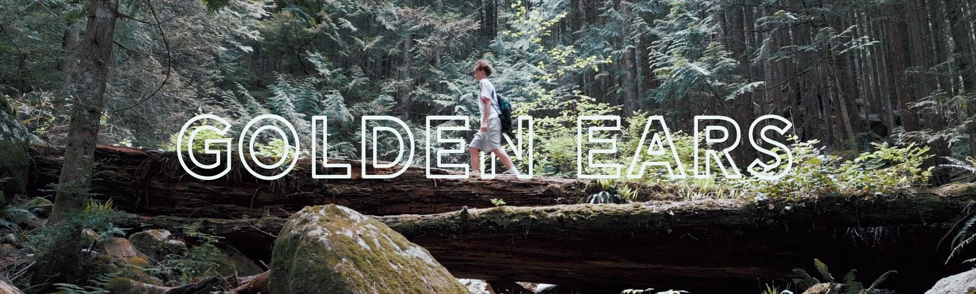
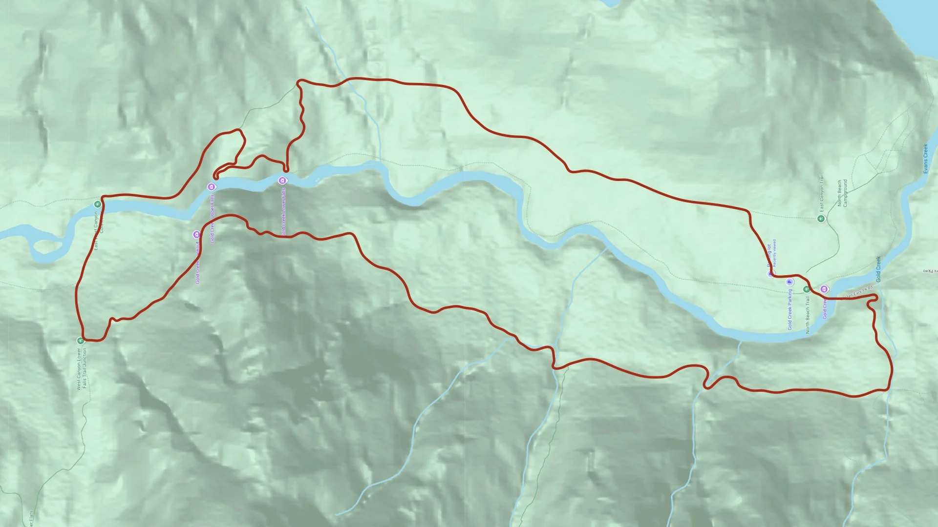
Upper Gold Creek Falls Loop
Golden Ears Provincial Park
Maple Ridge, BC
Hiked May 2026
Keaton’s First Take
Upper Gold Creek Falls felt like two different hikes. It started as an easy walk along an old logging road, but the route became much harder around the waterfalls and across the west side. The best part was standing near the falls and feeling the mist from the water. The terrain was rougher and more tiring than the elevation numbers suggested, but the viewpoints made the effort worth it. I would recommend the full loop to experienced hikers who enjoy longer routes and uneven terrain.
“The waterfalls made the harder sections feel completely worth the effort.”
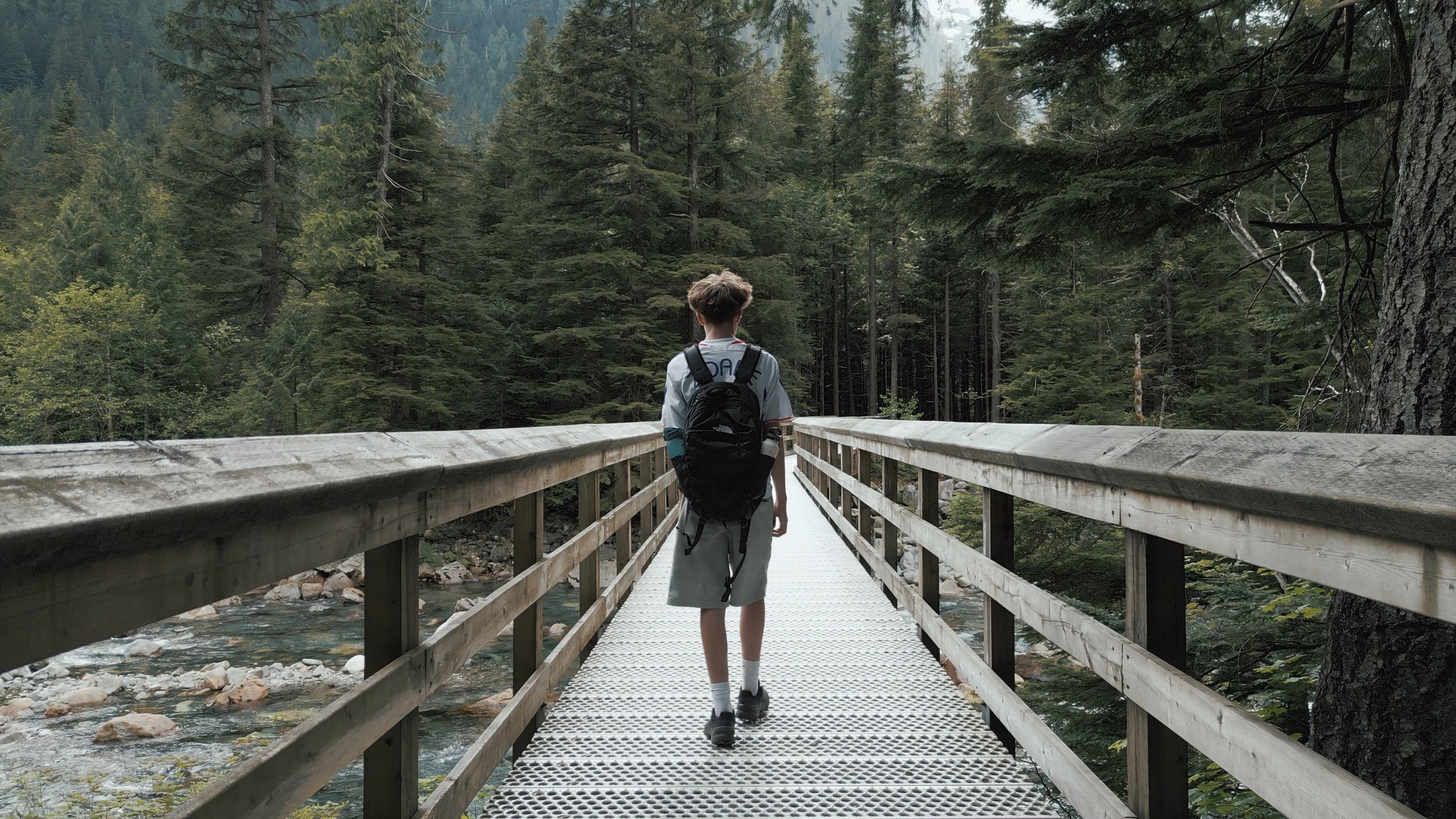
Upper Gold Creek Falls made my “to hike” list because it seemed to offer more variety than the other hikes I’ve done. The photos and reviews showed waterfalls, creek viewpoints and several places where you could get close to the water. The full loop was also the right distance for me. What interested me most was that the two sides of the creek were supposed to feel different, especially after crossing the bridge.
When we arrived at Golden Ears Provincial Park, the parking lot was already almost full. It was one of the busiest trailheads we visited, and there were park staff and security around the area. I expected the trail to feel just as crowded, but once we started walking, we hardly saw anyone.
A Busy Arrival and a Quiet Beginning at Upper Gold Creek Falls
“The parking lot was packed, but the trail felt surprisingly quiet.”
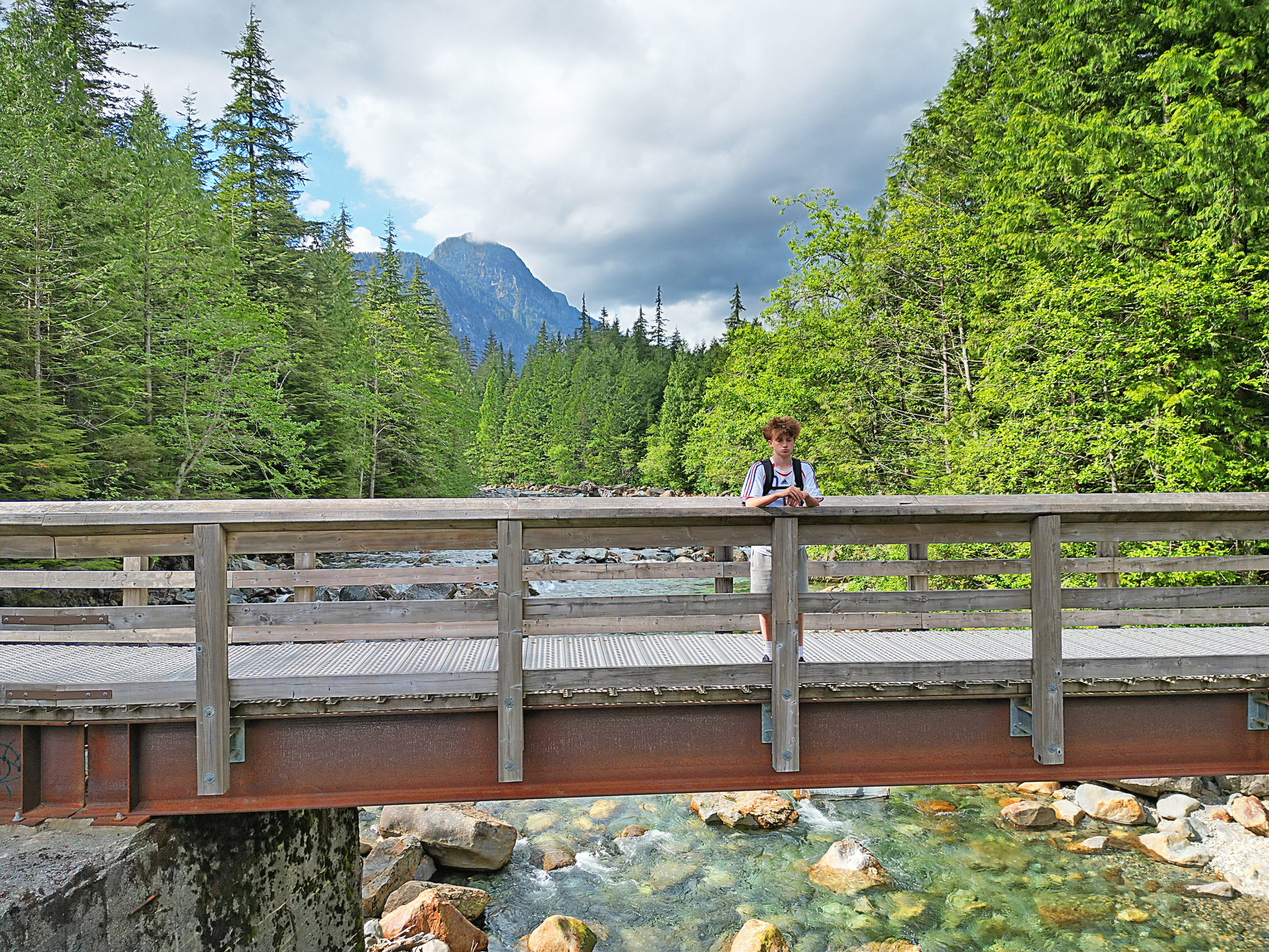
The opening section was much easier than I expected. It followed a wide, mostly flat path that felt more like an old logging or horse trail than a mountain hiking trail. That makes sense because parts of the East Canyon route follow old logging-road grades from the park’s earlier railroad logging period. The forest around us was thick with western hemlock, cedar and Douglas fir, but the wide trail kept the beginning from feeling closed in.
The weather was clear, and we could hear the creek and birds through the trees as we walked. Every so often, the forest opened enough to give us a better view toward the water or surrounding mountains. The calm beginning confirmed that this would be a scenic hike, but it also made the route feel easier than the descriptions had suggested. At that point, I was starting to wonder when the trail would change.
Upper Gold Creek Falls Loop
Golden Ears Provincial Park
Where the Logging Road Turned Into a Real Hike
The hike changed once we left the wide East Canyon trail and started heading down toward the falls. Until then, most of the route had felt like a long, flat walk on an old logging road. The path became narrower, steeper and less even, with rocks and roots replacing the smooth ground. That was the point when it started to feel like an actual hike instead of just an approach to one.
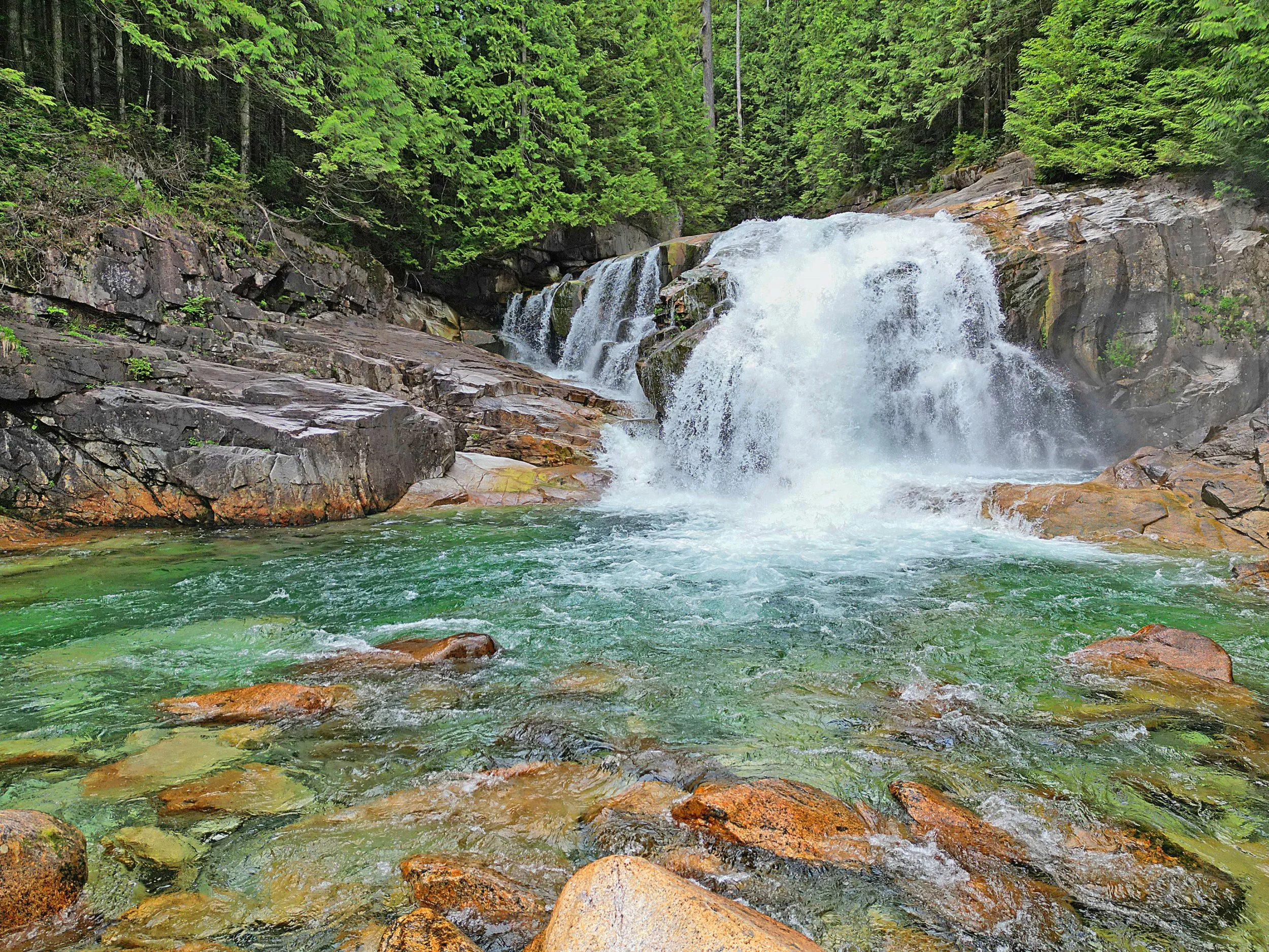
The section between the lower and upper falls was harder than I expected from looking at the distance and elevation numbers. There were short, steep parts where we had to watch our footing, and the route was not always marked as clearly as I thought it would be. The elevation gain did not look that serious on paper, but it was concentrated into rougher sections. By the time we reached the falls, I was tired enough that stopping there felt like a reward.
“The waterfall felt like a reward after the trail finally became difficult.”
The lower falls viewpoint was the moment I remember most clearly. There was a giant rock beside the waterfall that you could walk out onto, which put you close enough to feel the mist coming off the water. The noise of the falls was much louder from there, and it felt completely different from seeing the creek through the trees earlier in the hike. It was also busier because there is a shorter and easier trail leading directly to Lower Falls, but the viewpoint was still worth stopping for.
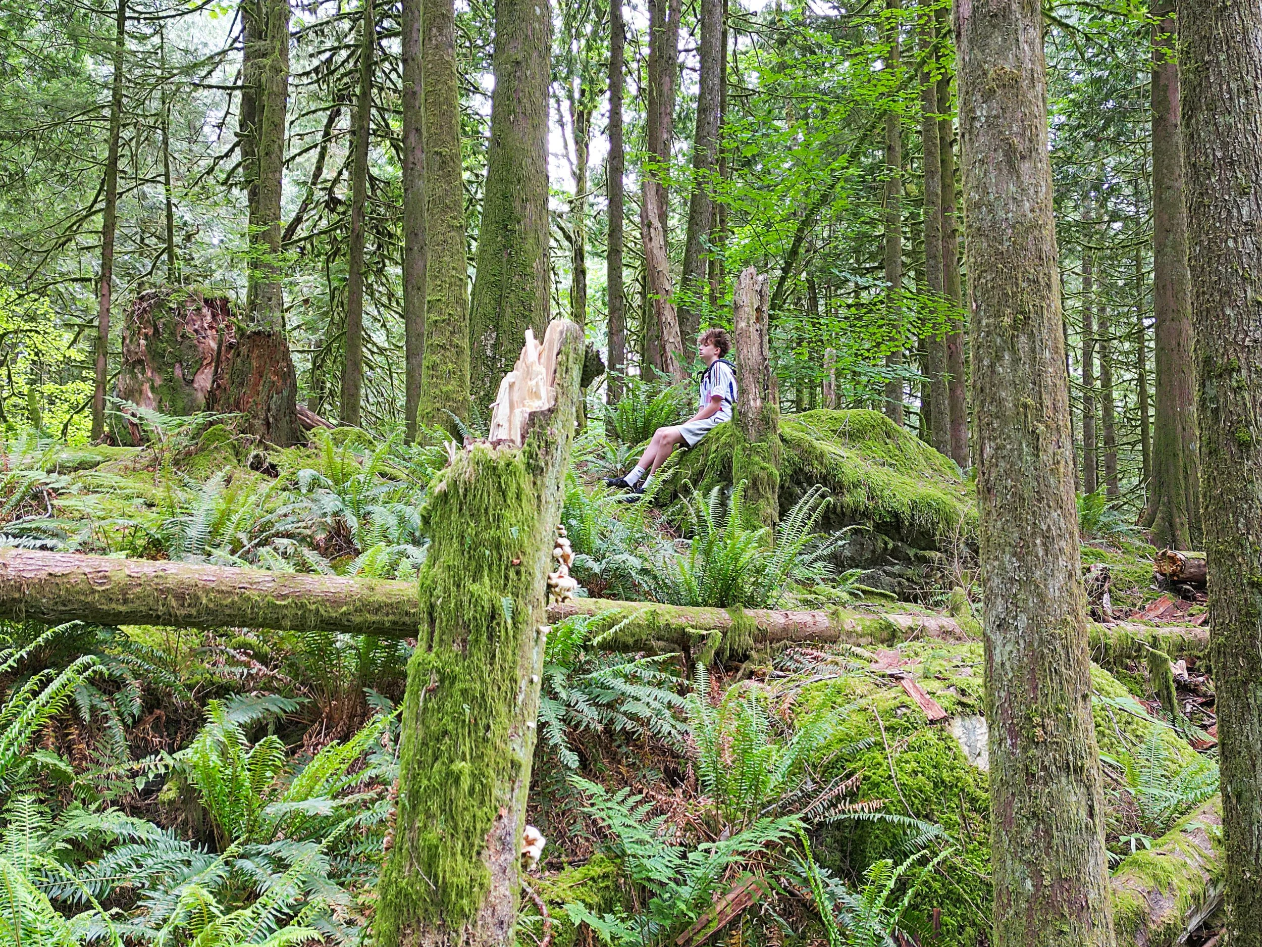
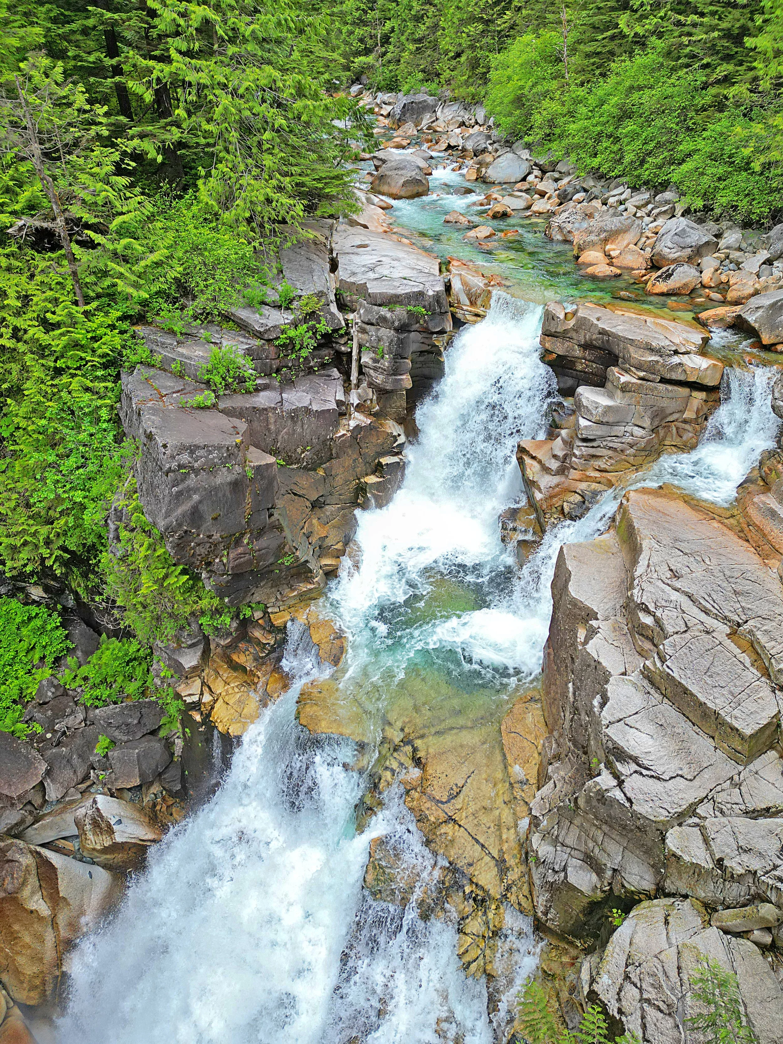
Upper Falls felt more separated from the main crowd. It took more effort to reach, and the route felt less formal, but that made the viewpoint feel more like part of the full hiking experience. Later, the west side continued the same pattern. The trail was rougher than the east side, with more roots, rocks and uneven ground, while several openings gave us views down into Gold Creek. Official descriptions classify the canyon route as moderate, but local trail guides also warn that these concentrated, rough sections can make the loop feel harder than its basic statistics suggest.
This part shaped how I thought about the entire hike. Some of the other trails had terrain that I enjoyed more consistently, but none of them had as many strong viewpoints. Reaching the falls after the trail became harder made the scenery feel earned, and that contrast was what made this hike stand out.
Expectations versus reality
Before vs After
What we thought going in… and what the hike actually felt like once we experienced it.
A Hard Finish That Changed How I Judged the Loop
The second half of the loop felt like a completely different hike from the beginning. The west side was narrower, rougher and more tiring, with roots, uneven ground, creek crossings and a few washed-out sections to work around. By then, we had already completed the easier east side and visited both waterfalls, so the difficulty felt greater because we were doing the hardest terrain after we were already tired. The final one-sixth became fairly flat again, but there were fewer views, and it started to feel more like a return to the parking lot than another part of the experience.
When we finally reached the trailhead, I mostly felt relieved. It was around 5:00, but the parking lot was still almost full, which showed how popular the park was. The route had felt like a hard 15 kilometres, not a hike that seemed shorter once it was over.
“The views were worth it, but the full loop definitely felt earned.”
Overall, the hike met and probably exceeded my expectations. The Upper Falls viewpoint was the strongest part because it felt more separate from the busiest areas, while Lower Falls gave us the closest and most powerful view of the water. Photos did not fully prepare me for the sound of the waterfalls or the mist you could feel while standing nearby. The main weakness was that the later west-side section did not have enough open viewpoints to match the effort it required. The terrain stayed interesting, but the scenery became less rewarding near the end.
I would recommend the full loop to hikers who are comfortable with longer distances, rough footing and sections where the difficulty is not obvious from the basic elevation numbers. People looking for a shorter hike with one clear destination may enjoy the Lower Falls route more. I would complete the full loop again, although I might begin closer to Lower Falls to reduce some of the repeated walking.
This hike changed how I compared the trails in the Capstone project. I learned that distance and total elevation do not explain where the difficulty happens. The direction of the loop, the condition of the trail and how tired you are when you reach the roughest section can matter just as much as the numbers.

Keaton’s Trail Scorecard
Trail Scorecard
Keaton’s scores reflect his experience completing the full loop.